Where the weather constantly changes in the Ohio Valley
Thursday, February 16, 2012
Winter storm threat for the state Saturday overnight- Sunday
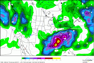
Latest 84 hours nam and 72 hour japanesse model( below) is in and it has all state of KY with accumulating snows on Sunday and heaviest snows 10-12"of wet snow in SE KY Wow! Louisville up to 3". This type of snow can knock can cause power outages. We are still little more than 2 days away and 1500 miles away so this will change. I believe this could shift further north. Time will tell. More updates later today.
Subscribe to:
Post Comments (Atom)


No comments:
Post a Comment