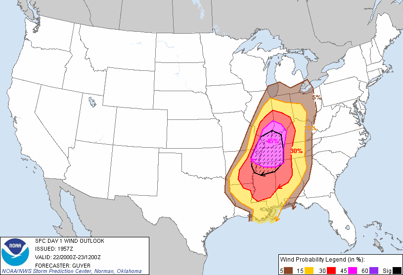
Temperatures will continue to rise thru the 50's to 60 by Monday am. Winds will increase after midnight. The best chances of severe weather after midnight will develop in west TN/KY where the best chances of tornadoes, wind damage, large hail. then it will move to Louisville before daybreak. Have your weather radio on tonight. Tornadoes of F1and F2 tonight across the moderate risk area top below is tornado risk and top below wind damage which could be excess of 70-80 mph.
.

No comments:
Post a Comment