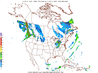
Highs today will be warmer than 40's. Highs approaching around 50 but just to our south 60's will be rule. The warm front just over top of us and low pressure will be to. Another soaker today.Watch standing high water and pounding on the roadways. Turning colder overnight-Friday early am with a chance of flurries/drizzles. Friday highs 43. Clouds to start. We should should breaks in the clouds. More clouds Friday night followed by snow by daybreak Saturday am as front passes through. Light accumulation is possible but temperatures is expected to be above freezing mark. It will be a squall line of snow behind the front. It will be early in the day. It will be very windy Saturday. Highs in the 30's.Winds will continue thru the weekend. Another clipper system dives in comes by Sunday midday and bring more snow. Light accumulation with that one also. Highs in the mid 30's Sunday. Look at the sim radar nam for both Sat and Sun snow.


No comments:
Post a Comment