Tuesday, January 31, 2012
Record warmth is possible today?
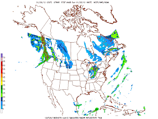
Highs today 66 or so degrees. Windy afternoon. Showers developing later evening or overnight. Am showers Wednesday. Highs in the 60 or better. Thursday and Friday dry. Highs in the 50's. The weekend is question mark as far as the weather. Right now initally we will see some rain at some point. We will have a cutoff low pressure storm system which is a headache to predict. There is model madness. No confidence whatsoever for the weekend weather. No snowstorm that the models are showing though but we will see snowflakes? Well time will tell. Long range the question is when will our pattern change back to winter. The longer it takes the colder the spring will be. Right now I stilll believe someime Feburary through April is the time period but it may be delay until March thru early May.
Sunday, January 29, 2012
Are the models giving some hope for winter lovers next weekend?????
Looking through the models today. It's brring a storm for next weekend. Gfs doesn't see as it is in it's usual 5-7 day error. The physics of the models. Non US models named canadian and Euro has a storm next weekend but solutions are diffrent. Canadian are showing a big storm in the lower Midwest- MO but at the end brings sn. Euro is further south in the Ohio Valley. Look the Euro. It suggests rain changing to snow Saturday lasting thru Sunday.
 We have to see as the week wears on how this unfolds. This is certainly possible. We will be in Feburary now. There are signs of a pattern change as well.

Saturday, January 28, 2012
Light rain this morning. PM windy. Winds continues Sunday. Highs in the 40's this weekend
Afternoon sunshine this afternoon and windy condition. Tomorrow snow showers stay north. Windy Monday and Tuesday and mild with highs in the 50's and 60's Tuesday. A chance of rain/t-storms Tuesday night- Wednesday. Late next week we may start seeing some colder moving in. We shall see.
Thursday, January 26, 2012
Rain/snow mix by daybreak Saturday am
Rain/snow mix is what most the models shows by Saturday daybreak. Rain will minimize accumulation. If we see all snow. Light accumulations. We will track this as we get closer to the event. A changeable forecast. Sunday models keeping light snow north of here. We will watch the trends.
Flood watch this afternoon then snow opprtunities for the weekend
Highs today will be warmer than 40's. Highs approaching around 50 but just to our south 60's will be rule. The warm front just over top of us and low pressure will be to. Another soaker today.Watch standing high water and pounding on the roadways. Turning colder overnight-Friday early am with a chance of flurries/drizzles. Friday highs 43. Clouds to start. We should should breaks in the clouds. More clouds Friday night followed by snow by daybreak Saturday am as front passes through. Light accumulation is possible but temperatures is expected to be above freezing mark. It will be a squall line of snow behind the front. It will be early in the day. It will be very windy Saturday. Highs in the 30's.Winds will continue thru the weekend. Another clipper system dives in comes by Sunday midday and bring more snow. Light accumulation with that one also. Highs in the mid 30's Sunday. Look at the sim radar nam for both Sat and Sun snow.


Wednesday, January 25, 2012
Rain moves in as early as midday otherwise main rains will move in overnight into Thursday
Lots of rain. Rainfall amounts 1-2" of rain. This will end Thursday night. No thunderstorms in the forecast now which is a change from last post. The warm front will stay south. Today highs will be near 40 and tomorrow low 40's. This could ends as light snow Thursday overnight. Some models are showing this and not rulling this out. Timing is different. Ukmet and Canadian light snow overnight Thursday night -early Friday am. GFS and nogaps has it east. We will see. A break Friday. Looking into the weekend. Models are struggling with this but a chance of light snow Saturday morning sometime and again Sunday. Gfs doesn't see all of this. Canadian and rest of the models does. I believe we will see snow this weekend but I don't know detail yet.
Monday, January 23, 2012
Pattern favors the return to winter late week
Good morning folks!Wild weather later this week. Here is the latest canadian models for Friday and Saturday snow systems we have to watch. Euro looks similar. Gfs has nothing for Friday. It's trying to sniff out snow late Saturday.

 Today highs in the upper 40's and Wednesday slightly cooler at 45. We have a chance of more t-storms Thursday. Some could be strong. Something to watch. Highs will be in the mid to upper 50's. Rain will be developing Wednesday evening. Warm front will be through during the day Thursday. Turning the colder by Friday am. Rain may end as snow.Look above again.


Subscribe to:
Posts (Atom)