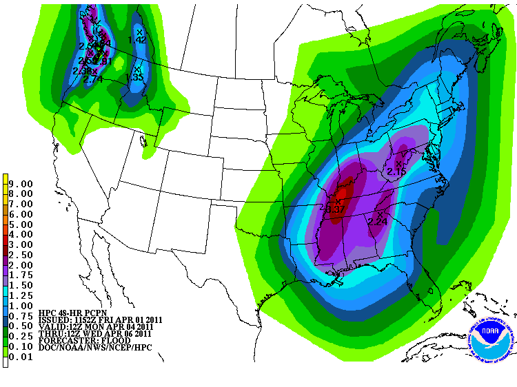
Happy April fool's Day. I didn't get chance to update this week. Took a time away but I'm here to give you an update on our severe weather threat for Monday and boy it looks impressive. Wind field ae impressive, temperatures are going to surge, and low will be strong. Main threat for Monday will tornadoes, large hail, damaging winds, and flash flooding. It looks to be during our NCAA BASKTBALL championship game. The weekend look good weatherwise. Highs Saturday reaching 60. Sunday in the 70's. It will be windy Sunday. May see few showers early Sunday am.. Here is the latest SPC for Monday threatening weather and hpc precipitation amounts thru Wed am. It has 2-3" across the area.
For Louisville in March
HIGH: 82 there were 2 days in the 80s and 5 days in the 70s
LOW: 31 there were 4 days at 32 degrees or colder
RAIN: 5.17: which was 117% of normal
SNOW: 0.3" which was 14% of normal

No comments:
Post a Comment